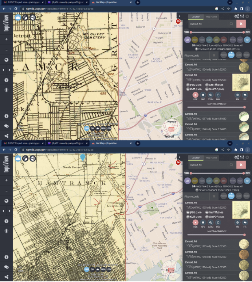
A map from 1905 of Detroit. The red circle is Leesville, a brick making center with a couple of ponds that may have been clay mines for the bricks. The arrows point to Connor Creek in Mt Olivet Cemetery and the valley is still there. The other arrow is St Cyril and the former beach that existed 1000s of years ago.
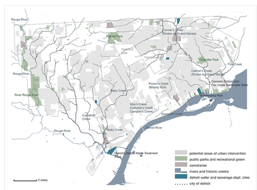
Conner Creek was "ghosted" and turned into a combined sewer in 1929. In the Mack-Jefferson area, the sewer consists of three rectangular barrels about 17'-9" high by 14'-3" wide. Going upstream from Mt Olivet Cemetery, the (semi)-natural Conner Creek divided and spread out east toward Gratiot, a small area in Macomb County and, the main tributary headed NW to the Mt Elliott & 8 Mile area. 1908 USGS Maps show semi-ditched headwaters west to Ryan. To me, ditched areas for agriculture indicate wetlands filled.
The Ryan & 8 Mile intersection is approx. where the Clinton River Watershed dipped south into Wayne County. The Clinton River Watershed boundary traveled SW to meet the Rouge River Watershed in Highland Park. From there, the boundary of the two rivers traveled NW along the very flat-broad ridge of the Detroit Waterlaid Moraine to the high point of the City of Detroit at Joe Louis Park(675') just SE of Wyoming & 8 Mile. The entire eastern Rouge Watershed boundary with the Clinton from Rochester Hills to Highland Park is along the Birmingham/Detroit Waterlaid Moraine(13,700yrs BP). The natural drainage from Palmer Park was NE into the Red Run Sub-shed of the Clinton River Watershed.
NOTE: The Detroit River is at approx. 575' elevation. There is 100' between high and low points—the city isn't quite as flat as one may think.
Today the Conner Creek Combined Sewer District gobbled up the Clinton Watershed in Wayne County and extends west to the Rouge Combined Sewer Districts. The Conner Creek Sewer of 1929 could not handle all this additional area. There are 2 trunk relief sewers: The First-Hamilton(near Palmer Park) and, the Conant-Mt Elliott which flow to the Detroit River Interceptor(DRI) but CSO to the Detroit River. The East Arm Interceptor which serves Macomb County also provides some relief near the intersection of 7 Mile & Van Dyke. Thru-out the last 200 yrs, Wayne, Macomb & Oakland Counties have said, "You keep the mess you are creating on your side of 8 Mile Rd.; we'll keep our mess on our side."
Palmer Park is now in the Conner Creek Combined Sewer District.
NOTE: One wetland ghosted that is well documented is Hubbard Marsh which extends miles north & south of 8 Mile Rd. west of Wyoming. To the north it is the headwaters of Red Run Drain; to the south it overflowed to Brightmoor Creek in the Rouge Watershed. Bob Muller has studied this area extensively.
I will write about Bloody Run later. You can't talk about Bl;oody Run without talking about other natural features.